Digital Matatus
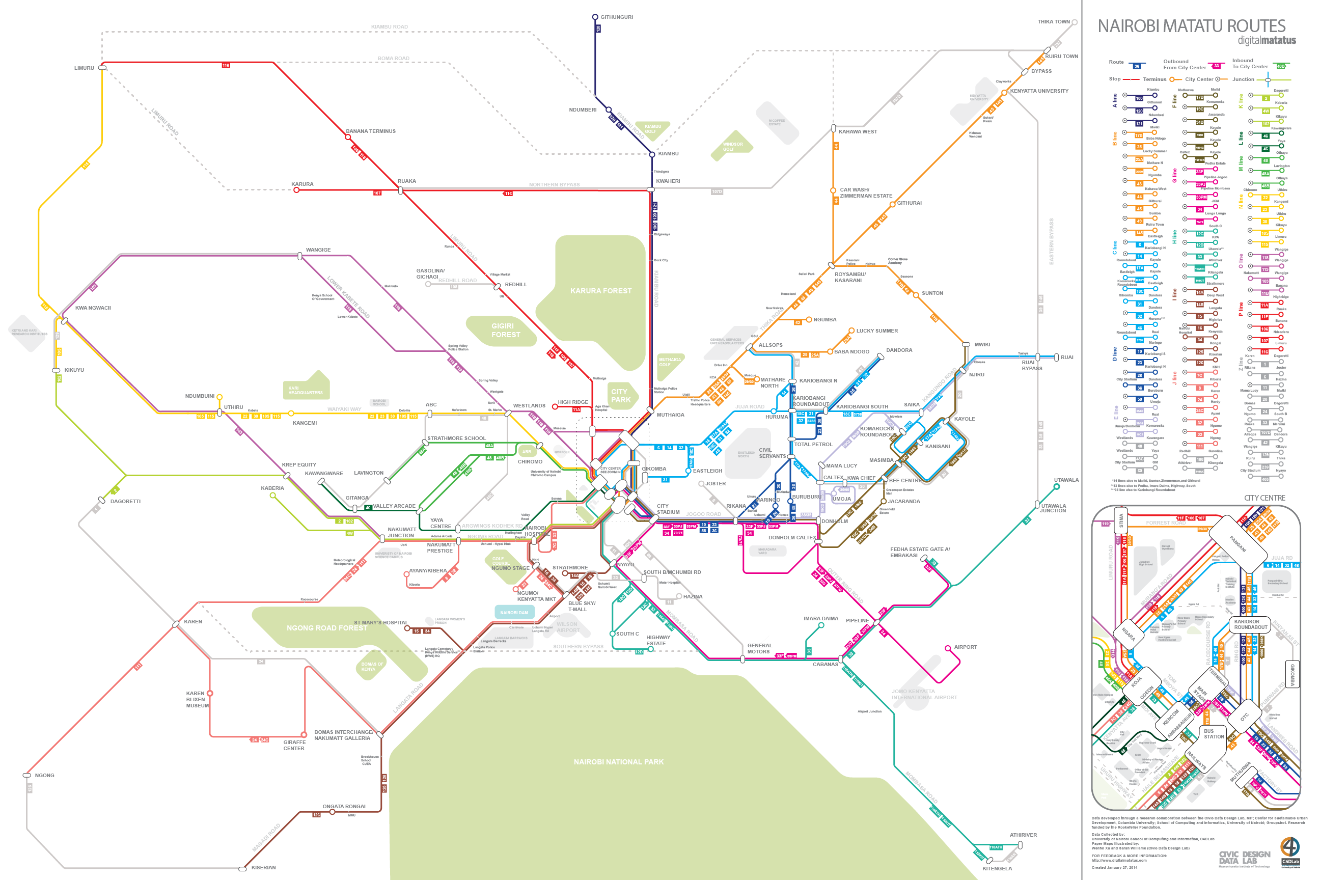
As part of the ongoing Digital Matatus project at the Civic Data Design Lab, a physical map was created from data collected on the informal bus transit system in Nairobi. The locational data was then abstracted in order to create a diagrammatic map of the matatu bus routes.
Through gaining an understanding on the general orientation of the city, important landmarks, the ways in which people use the matatu buses, and through feedback from University of Nairobi students as well as a taxi drivers in Nairobi, we created a map that designates different bus ‘lines’ and places a hierarchy on the various junctions intersecting the line.